Falls of the World · Farstep pack
Victoria Falls in 3D
Mosi-oa-Tunya
On the Zambezi River, between Zambia and Zimbabwe
Victoria Falls, Mosi-oa-Tunya, "the smoke that thunders", drops the Zambezi about 108 m into a chasm some 1,700 m long. In the wet season the spray can be seen from tens of kilometres away; in the dry season the curtain breaks into separate sheets. Below, the river zigzags through gorges that mark where the falls once stood.
Key facts
- Where
- On the Zambezi River, between Zambia and Zimbabwe
- Drop
- About 108 m
- Width
- A chasm some 1,700 m long
- Name
- Mosi-oa-Tunya, "the smoke that thunders"
- UNESCO World Heritage
- 1989
Walk Victoria Falls in 3D
A real-time 3D model, built from open elevation data and published measurements. Loads 2.3 MB when you start.
Victoria Falls
Walk it yourself. Works on this phone.
Part of the Falls of the World pack: a one-time unlock in this browser.
Building Victoria Falls…
Terrain from open elevation data · a 3D reconstruction, not a photograph · tags as in the app
What you'll find in the walk
Gold markers in the scene open these cards.
Mosi-oa-Tunya
KnownThe Kololo name means "the smoke that thunders". In the wet season the spray can be seen from tens of kilometres away.
The main falls
KnownThe Zambezi drops about 108 m into a chasm some 1,700 m long. In the dry season the curtain breaks into separate sheets with bare rock between them.
The zigzag gorges
KnownBelow the falls the river turns through a series of gorges. Each marks an earlier position of the falls, cut back along weak joints in the basalt.
How to visit in real life
The falls can be seen from both the Zambian and the Zimbabwean sides, from paths along the facing edge of the chasm. Expect to get soaked in the high-water months.
Access, seasons and permits change: check locally before you go.

Walk them all in Farstep
The full site on your phone: a narrated guided tour, passport stamps, offline, and smoother graphics than a browser can give.
- Narrated guided tour, stop by stop, in nine languages
- Passport stamps for every hotspot and finished tour
- Works offline once installed
- Stonehenge free; other sites are one-time packs. No ads, no subscription.
Open in Farstep
On iPhone the button opens the App Store.
More in Falls of the World
More wonders in 3D
Free
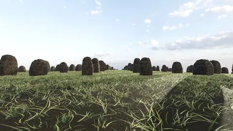
Stonehenge
Midwinter sunset on the axis
Everest summit ridge
Real elevation data · 8,849 m
Grand Canyon
USGS elevation · South Rim
Yosemite Valley
USGS elevation · beneath El Capitan
Avebury
The great henge
Newgrange
Exterior · the mound and kerb
Skara Brae
Neolithic village, Orkney
Callanish Stones
Isle of Lewis
Carnac
The Ménec alignments
Hadrian's Wall
Open LiDAR terrain · Housesteads